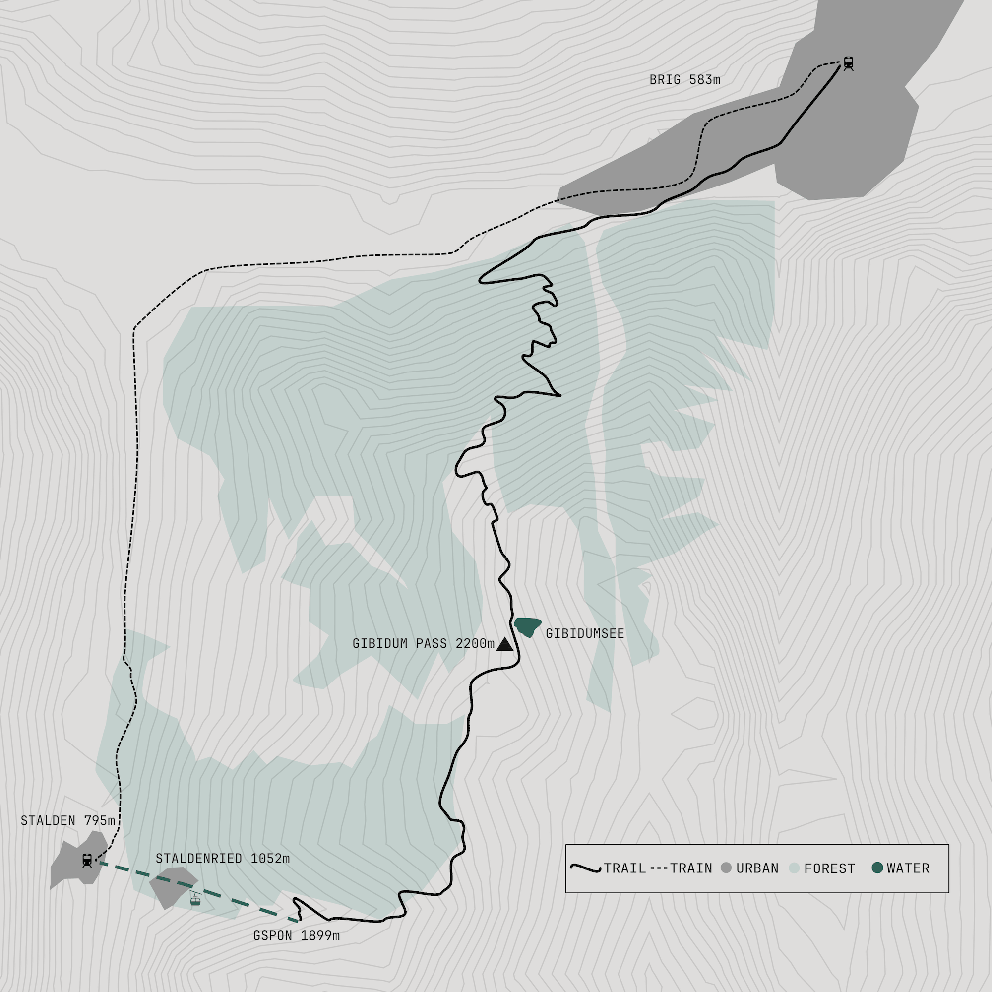
Switzerland is a country of passes, and it is easy to become obsessed with crossing them. Gibidumpass is a good introduction to the sport of pass storming: a high crossing above the Valais with a little mechanical assistance at the beginning and more than a thousand metres of descent at the other end.
The ride starts in Stalden, where a remarkably small cable car climbs to Gspon. Two people and their bikes can squeeze inside, although there is little room for anything else. Gspon is a small, car-free mountain village perched above the Visp valley, and from here the route heads towards the pass through the Sädelwald forest.
The climb is steady rather than brutal, following a mixture of singletrack and wider mountain paths. There are a few steeper sections before the trees begin to thin and the landscape opens out. At around 2,200 metres, Gibidumpass appears as a high plateau with a small lake, Gibidumsee, beside the trail.
This is the place to stop. The lake is fed by the historic Heido irrigation channel and, being only around two metres deep, warms quickly in summer. Beyond it the views stretch across the Valais towards the Weisshorn, Balfrin and Bietschhorn.
The character of the ride changes at the pass. The trail drops steeply into the wild Nanztal, initially on a fast, flowing descent before becoming more varied. There are sections of singletrack, rougher mountain paths and tighter turns, with the valley dropping away beside the trail. At Alp Nidristi the route begins to settle into a longer, faster descent towards Schratt.
Lower down, the landscape becomes greener and the track easier to ride. The route eventually emerges towards Brig, with the mountains of the upper Valais opening out behind you. After the isolation of the Nanztal, the arrival in town feels surprisingly abrupt.
Brig is the natural end to the ride. From here, the railway provides an easy return towards Stalden and the Zermatt valley.
The route is now signposted as the Gspon Panorama Bike, running from Gspon via Gibidumpass to Brig. The current route gives approximately 415 metres of climbing and 1,635 metres of descent, with the high point at around 2,200 metres.
Route data
| Distance | 23.8 km |
|---|---|
| Ascent | 416 m |
| Descent | 1,212 m* |
| Start | Stalden / Gspon |
| Finish | Brig |
| High point | Gibidumpass, c. 2,200 m |